Importing roads from OpenStreetMap
Import mode turns raw OpenStreetMap data into a simulation-ready network. You choose where and what to import; Road Mesh fetches current data through the Overpass API and normalizes it into an editable model.
Choose a location and import area
Use the search field in the left panel to find any city, road or area (powered by Nominatim), or pan and zoom the map directly. Then define the import area: drag a rectangle on the map, or press “Use current view” in the toolbar to adopt what is on screen. The inspector shows the selected area's size against your plan's import-area limit before anything is fetched.
The area can also be a circle. Turn on “Show import-area shape picker” under Settings → Import and the inspector gains a Rectangle / Circle switch: drag the circle's center to move it and its east handle to resize it. Only roads inside the disc are fetched, and the import-area limit is checked against the disc's area rather than its bounding box — handy for a single interchange or town center. A project remembers which shape it was imported with.
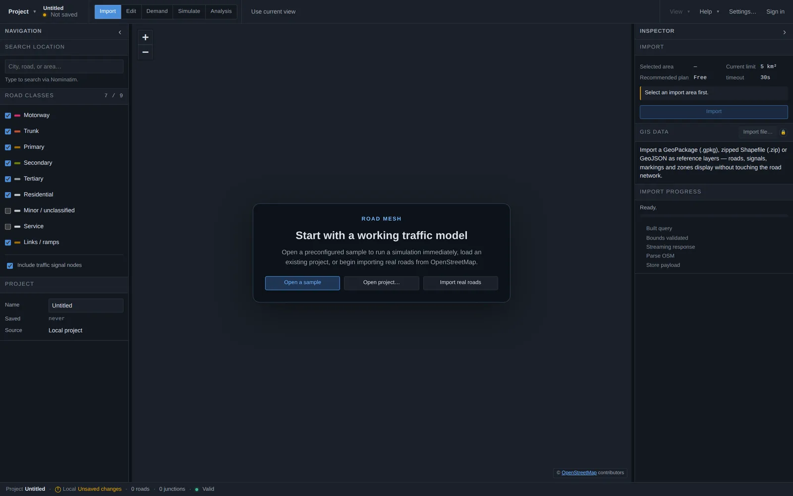
Pick road classes
The Road classes checklist controls which OpenStreetMap road categories are fetched — from motorways and trunks down to residential, service roads and links/ramps. Including traffic-signal nodes lets the importer place signals where OpenStreetMap knows about them. Fewer classes means a smaller, faster network; more classes means more complete local circulation.
What happens during import
Raw OpenStreetMap ways are not a simulation network, so the import pipeline normalizes them automatically. The Import progress panel shows each stage as it runs:
- Geometry becomes editable centerline splines in a local, meter-based coordinate system (the map location is remembered for map overlay and exports).
- Lane counts, directions and speed limits are inferred from OpenStreetMap tags; ambiguous or missing data is flagged in the validation panel rather than silently guessed.
- Junctions are detected from topology, and multi-node signalized crossings are clustered into unified junction areas with curved lane connectors for turn movements.
- Junctions that look signalized get coordinated multi-phase signal timings, including protected left turns.
- Motorway ramps are attached to their merge and diverge lanes automatically.
- A routable lane graph is built — the structure vehicles route and drive on.
Traceability and limits
Every imported road keeps its original OpenStreetMap way ID and tags (visible via the inspector's Technical info toggle), so the model stays traceable back to its source. Network quality follows OpenStreetMap quality — where tagging is thin, review the flagged defaults before relying on results.
Each plan has a maximum import area per network; the inspector shows the current limit up front. Import times depend on the public Overpass API, which can be slow for very large or busy areas.
Other data sources
Import mode can also load GIS files as visual reference layers alongside the road network, and Edit mode hosts the full file-based import workflows — GIS network import, CAD drawings and LandXML civil designs. Those are covered in the GIS, CAD and LandXML chapter.